LIDAR 3D Point Cloud Annotation Tool from TrainingData.io
We are very excited to announce the general availability of a 3D point cloud annotation tool for datasets generated by LIDARs. It is well known that the autonomous driving industry is philosophically divided into two camps. One camp believes computer vision (camera sensor) to be sufficient for building the perception model of the real world. The other camp believes computer vision can never be sufficient alone and, needs fusion with a radar-like system called LIDAR for building reliable perception models of real-world objects.
TrainingData.io has been providing, to its customers, world-class semi-automatic workflow for annotation of datasets consisting of images and videos generated by camera systems. Now, in addition to computer vision datasets, data-scientists can easily annotate datasets generated by LIDAR systems.

The features include the following:
- Import point cloud files generated by LIDAR equipment from a wide variety of manufacturers.
- Define custom classes, attributes, ontology, questionnaire for every annotation job.
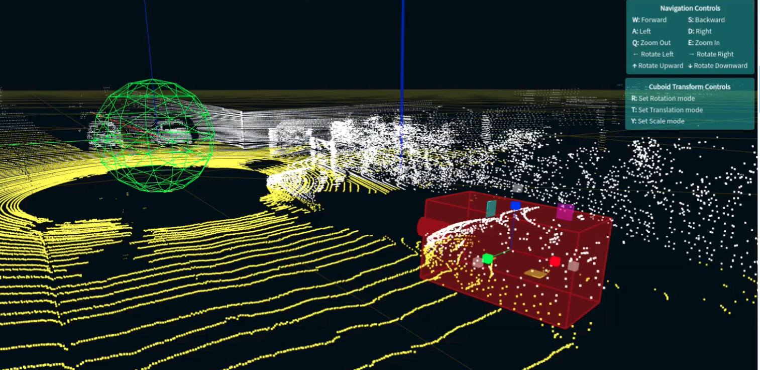
- Navigation of 3D space using a keyboard.
- Ability to draw cuboid annotation around for every object in the scene
- Tracking each annotation through all the frames in the dataset.
- Edit cuboid includes translation, scaling, and rotation.